









Work Offline, Sync Later
Scan room dimensions, even without internet.

Connected AV Workflow
Move site data straight into
design.

Centralized Site Data
Keep scans, photos, and notes in one place.

Less Rework
Automate manual work and speed up surveys.
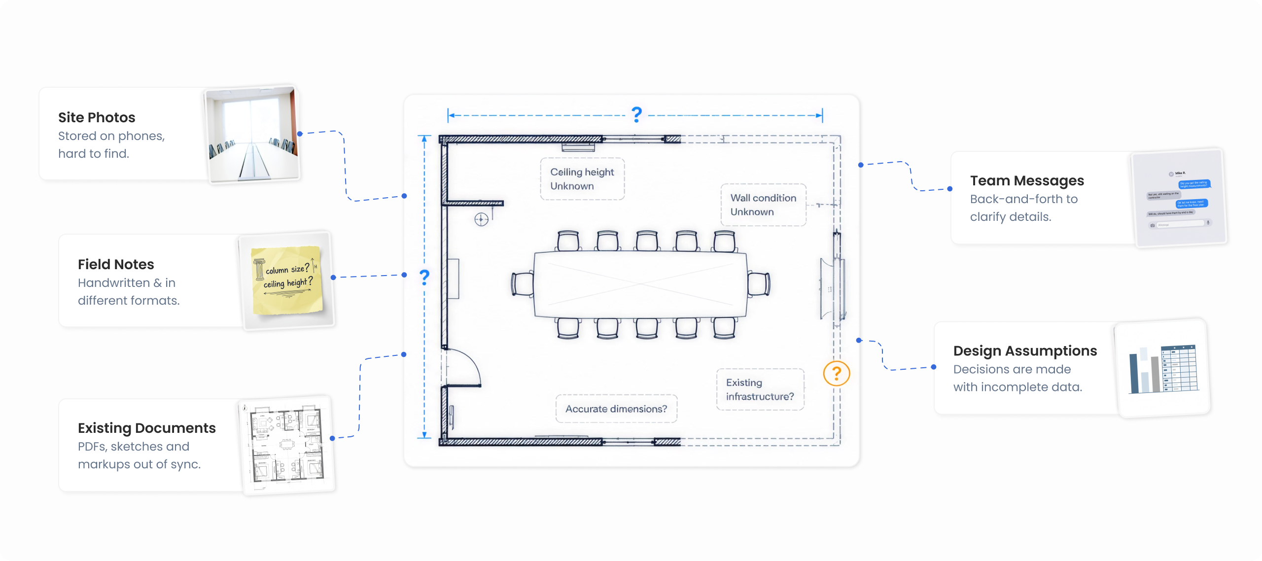
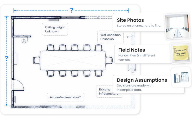
Site Surveys Become Difficult When
Information Lives Everywhere
Manual surveys, scattered notes, and missing details lead to design errors, rework, and project delays.
Turn Every Site Visit Into Design-Ready AV Data


Dimensioned Floor Plans

3D Spatial Capture

Works Offline

Room-Level Site Context

Everything You Need to Capture a Site
Before AV Design Begins
From the first room scan to the final site report, keep the information collected during
the survey
organized and ready for the next stage of the project.

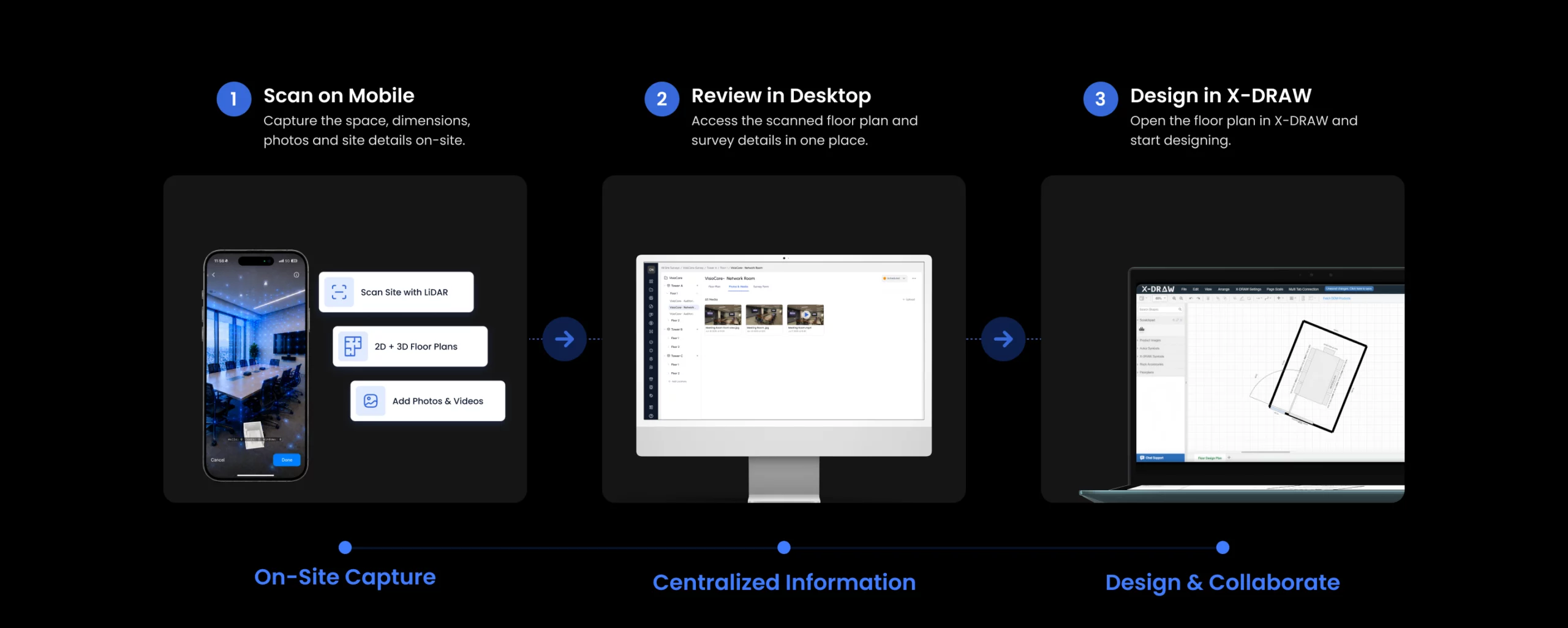
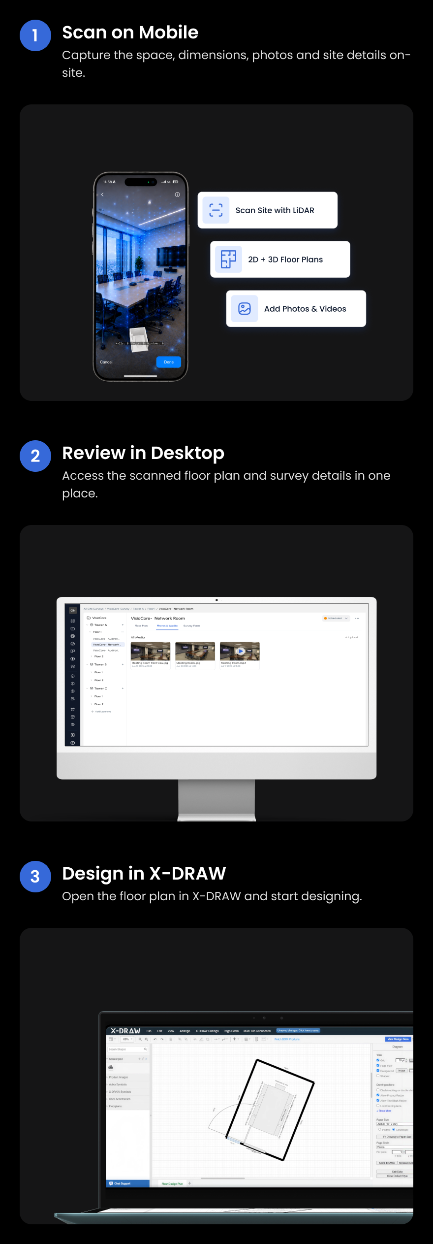
Generate 2D Floor Plans
Use LiDAR to scan the room and create a 2D floor plan, reviewing walls and layout without manual reconstruction.

Capture Spaces in 3D
Develop a detailed 3D model of the room for designers to visualize the space and its conditions alongside measurements and plans.

AI-Assisted Survey Templates
Choose the right survey template before starting. AI can auto-fill fields with data from the site visit for easier review.

Capture Photos & Videos
Capture photos and videos with the XTEN-AV app during the survey, keeping media organized within the project for easy reference.

Generate Site Survey Reports
Combine measurements, plans, media, and survey data into structured reports for stakeholders to understand site conditions before AV planning.

Connect Site Data to X-DRAW
Import completed survey data into XTEN-AV, using real site conditions as the foundation for your AV system design.

Work Offline on Site
Continue surveying without internet access. Capture data on your mobile device and sync it to the project once reconnected.

Upload Existing Floor Plans
Have an existing site drawing? Upload floor plans to integrate them with new survey data and documentation.
From Site Visit to Design File in One Flow
See How Site Survey Simplifies the AV Workflow
| CATEGORY |
 WITHOUT SITE SURVEY
|
 WITH SITE SURVEY
|
|---|---|---|
 Measurements
|
Measure rooms manually and record dimensions separately |
Capture room dimensions through LiDAR scanning
|
 Floor Plans
|
Draw or recreate room layouts after the site visit |
Generate dimensioned 2D floor plans from captured spaces
|
 3D Context
|
Rely on photos and notes to understand the room |
Review a 3D representation of the surveyed space
|
 Survey Forms
|
Enter site information into forms manually |
Use AI to map captured information into relevant survey fields
|
 Photos & Videos
|
Store site media in phone galleries and separate folders |
Keep photos and videos organized by project and room
|
 Site Information
|
Spread details across notes, files, emails and devices |
Keep survey information connected within the project
|
 Documentation
|
Compile site documentation after returning from the field |
Generate structured reports from accumulated survey information
|
 Design
|
Recreate site conditions before AV design can begin |
Start with design-ready information captured from the actual site
|